It's been a month and a half since the last posting. It doesn't seem that long since three weeks of it were spent in Europe. We had a great time and saw lots of things that will help at Raccoon Creek Community.
Since returning we have met with Red Tail Timber Frames owner and have agree to have them manage the reconstruction of our barn. They will begin in early August.
Missing posts and beams - parts that had rotted in the barn before we dismanteled it - will be replaced with timbers harvested from areas which will become ponds on the Raccoon Creek site. Red Tail will pull them from the woods using their draft horses, and mill them with their portable saw mill.
We have taken out a building permit for the barn, talked again with our REMC and gotten a quote from a well driller. Soon we will erect a tent or two and some screen tents so we can work at the site for a few days in a row without traveling back and forth so often.
If you've been wanting to visit the site, these next few weekends would be a great time. After that we should be very busy working on the barn.
Thursday, July 20, 2006


Thursday, June 01, 2006
Where have we been?
It's been about 3 weeks since the last posting. I've been occupied helping an elderly family member who has been in and out of the hospital and rehabilitation centers for the last 10 weeks or so. Except for the permaculture class week, it's been nearly an every-day visit to one facility or another.
Things have settled down and steady improvement is evidenced so we feel we can "safely" follow through with a long-planned, three-week trip to Europe that begins next week - on Wednesday the 7th. I hope to visit co-housing sites and see and learn about sustainable energy generation in Germany, The Netherlands and Sweden. If possible I'll post some entries showing what I've seen.
Until then I encourage you to visit the Rosneath Farm web site. Rosneath Farm is located in Australia, south of Perth, but their web site has much information that applies to any co-housing location.
They have obviously put lots of work into their effort. If you read something that you want to discuss with the Raccoon Creek Community, post a message to the RaccoonCreekForum. An easy fill-in for joining the Forum is located in the column on the left side of this page.
Things have settled down and steady improvement is evidenced so we feel we can "safely" follow through with a long-planned, three-week trip to Europe that begins next week - on Wednesday the 7th. I hope to visit co-housing sites and see and learn about sustainable energy generation in Germany, The Netherlands and Sweden. If possible I'll post some entries showing what I've seen.
Until then I encourage you to visit the Rosneath Farm web site. Rosneath Farm is located in Australia, south of Perth, but their web site has much information that applies to any co-housing location.
They have obviously put lots of work into their effort. If you read something that you want to discuss with the Raccoon Creek Community, post a message to the RaccoonCreekForum. An easy fill-in for joining the Forum is located in the column on the left side of this page.
Monday, May 15, 2006
What a difference a week makes
Our second eight-day class is complete and three of us now hold certificates for the Permaculture Design Course. We're not experts yet, but we have done, as part of the course, a very extensive design for the layout of the Raccoon Creek Community.
The plan includes the location for the community center (barn), the housing areas, one east and one west on the north side of the community property, a new spur on the road to reach the west-side properties, new pond sites which will store water yet not disturb the existing wetland, orchards sited along contour lines south of the comunity center, multiple garden sites, signage locations and much, much more.
The plan includes a modern version of chinampas on a new pond, not on man-made islands as most of the Aztec chinampas were, but as fingers into the pond. One exciting revelation from defeloping the plan is the potential to water many of the gardens and most of the orchards using gravity and pond water.
I will post some sketches of the class project soon.
The plan includes the location for the community center (barn), the housing areas, one east and one west on the north side of the community property, a new spur on the road to reach the west-side properties, new pond sites which will store water yet not disturb the existing wetland, orchards sited along contour lines south of the comunity center, multiple garden sites, signage locations and much, much more.
The plan includes a modern version of chinampas on a new pond, not on man-made islands as most of the Aztec chinampas were, but as fingers into the pond. One exciting revelation from defeloping the plan is the potential to water many of the gardens and most of the orchards using gravity and pond water.
I will post some sketches of the class project soon.
Tuesday, May 02, 2006
On the level!
News flash: Never try to use a level that isn't!
Last Friday afternoon and most of Saturday was spent at the site constructing a structure to house our toilet facility. We set up a canvas shelter last spring and it has been passable for us members, but starting Friday and running all next week we will have the Permaculture Class participants on site often and the canvas (not to mention the idea of it being the shelter) was wearing pretty thin.
The new shelter was designed (and I use the term loosely) to be large enough not only to sit down in a private, dry, level place, but also to allow storage of extra buckets, saw dust and paper, storage for tools and other things that need minimum protection from the weather, and provide a place to change clothes and hang up a few items while working at the site.
I had four treated 4X4 8-foot poles and two that size that aren't treated to work with, plus lots of miscellaneous wood from the old barn. The poles were part of a large lumber buy made at an auction some years back, and since I was doing the work by myself and there wasn't planned to be anything but dirt to hold them in the ground, I was grateful that they're treated. In the best of circumstances, though, they would not be and we would encase them in clay or concrete and paint them.
The plan was to make the inside of the structure 6 feet by 6 feet, cover it with 8-foot roofing sheets from the barn, and build a heavy-duty metal grid floor from shelf material like one might find at a Lowes or Home Depot which I had left over from building the greenhouse shelves at home.
I started digging using a shovel and a post-hole digger. When it was deep enough I put a piece of flat limestone in the bottom and filled it in with the heavy clay that had been removed. The clay proved to be the predominant component of the soil where I dug. The site is in the woods, north of the smaller clearing. I hope this clay isn't everywhere we dig, but finding it here, in an area much like where homes will be built, makes me believe we will have plenty to use if we choose to use an earthen finish on foundations or walls.
Next came making the post perpendicular. This wasn't too hard, especially since the soil was loose and I didn't plan to tap it down hard until all four were in place and braced.
The second hole was centered a little more than 6 feet away, and it went in just as easily. There wasn't much need to worry about it until the third pole was set and the right angle established between them. (Sure wish I'd brought a carpenter's square.)
While pushing and tapping each of the three posts to get them both perpendicular and as close to 6 feet apart as possible, I was having a heck of a time getting them right. I'd tap a post about an inch to level the bubble, tamp down the earth around the post and hold the level up to it again. It was off the other way! I'd repeat the process and hold the level upright against it again. Back the other way! Was I just getting hungry and doing a sloppy job?
It finally occurred to me to test the level. I held it against the post, eyeballed the bubble, and turned it in my hand 180 degrees. The bubble was somewhere else. The level was off!! This is a very nice level which I bought cheap (the keyword) at a store closing. It has three small slides on it to aid in putting up pictures and such. The slides have holes in their centers through which one marks the spot for nails. Very precise, and level in the horizontal dimension. But I had never used it in the vertical position before. Lesson learned.
In the end, I reminded myself that this shelter was being used for our temporary toilet and decided that most users would have plenty to keep themselves busy in there and wouldn't be critical if the posts were not perfect. I tried to average the bubble position between the two sides and nailed up diagonal braces going each way on three of the structures four sides.
The two non-treated posts were used for top plates on opposite sides, some old wood from the barn became the end pieces connecting the two top plates. The metal roof sheets were placed and nailed without incident. I added one more than needed and let it extend beyond the end of the headers more than two feet. Since they were already more than a foot longer than the building, the total width of the extension beyond the uprights is now about 3 feet.
I'll add a picture when I remember to take batteries for the camera.
The old tarp is back in use as the side cover for more than half of the building, the part that could possibly be seen into from the path. The other half is open to the world, at least until I find the best way to cover it. No one can approach the structure from the uncovered side unless they want to bushwhack, and a user would hear them coming. In a few days I'll add the metal floor grids, and we'll be ready for customers, so to speak.
Last Friday afternoon and most of Saturday was spent at the site constructing a structure to house our toilet facility. We set up a canvas shelter last spring and it has been passable for us members, but starting Friday and running all next week we will have the Permaculture Class participants on site often and the canvas (not to mention the idea of it being the shelter) was wearing pretty thin.
The new shelter was designed (and I use the term loosely) to be large enough not only to sit down in a private, dry, level place, but also to allow storage of extra buckets, saw dust and paper, storage for tools and other things that need minimum protection from the weather, and provide a place to change clothes and hang up a few items while working at the site.
I had four treated 4X4 8-foot poles and two that size that aren't treated to work with, plus lots of miscellaneous wood from the old barn. The poles were part of a large lumber buy made at an auction some years back, and since I was doing the work by myself and there wasn't planned to be anything but dirt to hold them in the ground, I was grateful that they're treated. In the best of circumstances, though, they would not be and we would encase them in clay or concrete and paint them.
The plan was to make the inside of the structure 6 feet by 6 feet, cover it with 8-foot roofing sheets from the barn, and build a heavy-duty metal grid floor from shelf material like one might find at a Lowes or Home Depot which I had left over from building the greenhouse shelves at home.
I started digging using a shovel and a post-hole digger. When it was deep enough I put a piece of flat limestone in the bottom and filled it in with the heavy clay that had been removed. The clay proved to be the predominant component of the soil where I dug. The site is in the woods, north of the smaller clearing. I hope this clay isn't everywhere we dig, but finding it here, in an area much like where homes will be built, makes me believe we will have plenty to use if we choose to use an earthen finish on foundations or walls.
Next came making the post perpendicular. This wasn't too hard, especially since the soil was loose and I didn't plan to tap it down hard until all four were in place and braced.
The second hole was centered a little more than 6 feet away, and it went in just as easily. There wasn't much need to worry about it until the third pole was set and the right angle established between them. (Sure wish I'd brought a carpenter's square.)
While pushing and tapping each of the three posts to get them both perpendicular and as close to 6 feet apart as possible, I was having a heck of a time getting them right. I'd tap a post about an inch to level the bubble, tamp down the earth around the post and hold the level up to it again. It was off the other way! I'd repeat the process and hold the level upright against it again. Back the other way! Was I just getting hungry and doing a sloppy job?
It finally occurred to me to test the level. I held it against the post, eyeballed the bubble, and turned it in my hand 180 degrees. The bubble was somewhere else. The level was off!! This is a very nice level which I bought cheap (the keyword) at a store closing. It has three small slides on it to aid in putting up pictures and such. The slides have holes in their centers through which one marks the spot for nails. Very precise, and level in the horizontal dimension. But I had never used it in the vertical position before. Lesson learned.
In the end, I reminded myself that this shelter was being used for our temporary toilet and decided that most users would have plenty to keep themselves busy in there and wouldn't be critical if the posts were not perfect. I tried to average the bubble position between the two sides and nailed up diagonal braces going each way on three of the structures four sides.
The two non-treated posts were used for top plates on opposite sides, some old wood from the barn became the end pieces connecting the two top plates. The metal roof sheets were placed and nailed without incident. I added one more than needed and let it extend beyond the end of the headers more than two feet. Since they were already more than a foot longer than the building, the total width of the extension beyond the uprights is now about 3 feet.
I'll add a picture when I remember to take batteries for the camera.
The old tarp is back in use as the side cover for more than half of the building, the part that could possibly be seen into from the path. The other half is open to the world, at least until I find the best way to cover it. No one can approach the structure from the uncovered side unless they want to bushwhack, and a user would hear them coming. In a few days I'll add the metal floor grids, and we'll be ready for customers, so to speak.
Wednesday, April 26, 2006
Road work
This is just a quick note since it's been a while since the last entry. Last weekend we finished about all we can do with the new road route without some larger equipment.
There are about a dozen trees too big to dig out without help. We could cut them off at the ground, but the threat of new shoots growing from the roots in the middle of the road is too great. A large machine can push them over and most of the roots will remain attached to the trunk so we can cut them off and dig out the rest.
We have seen wild turkeys on the site each of the last three weekends. Last Sunday morning a pileated woodpecker woke us early and stayed a while nearby. It's been around each weekend lately, but this time I saw it overhead. The peepers weren't as active, but the tree frogs have taken up the slack.
Marsh mallows are at the end of their blooming cycle, but larkspurs are up now near the creek along with plenty of the regulars. Most of the fern varieties are already refreshed.
This weekend we will construct a more substantial outhouse in preparation for the Permaculture Practicum which begins on May 5th. Class information is available on our Community web site. A link is in the righthand column.
There are about a dozen trees too big to dig out without help. We could cut them off at the ground, but the threat of new shoots growing from the roots in the middle of the road is too great. A large machine can push them over and most of the roots will remain attached to the trunk so we can cut them off and dig out the rest.
We have seen wild turkeys on the site each of the last three weekends. Last Sunday morning a pileated woodpecker woke us early and stayed a while nearby. It's been around each weekend lately, but this time I saw it overhead. The peepers weren't as active, but the tree frogs have taken up the slack.
Marsh mallows are at the end of their blooming cycle, but larkspurs are up now near the creek along with plenty of the regulars. Most of the fern varieties are already refreshed.
This weekend we will construct a more substantial outhouse in preparation for the Permaculture Practicum which begins on May 5th. Class information is available on our Community web site. A link is in the righthand column.
Tuesday, April 04, 2006
On the road
We've been planning and drawing and talking and it was finally time to do something that we can see on the site. So last Saturday we started our new road.
Instead of the existing road which winds east, north and northwest from the bridge over Raccoon Creek to the clearing, the new road is being routed almost directly to the site where the barn will be erected. In four hours two of us cleared about 60 feet of brambles, vines and small trees. We have marked the route so far to avoid any significant trees and only had to take out four that were less than four inches in diameter, a few less that 1 inch across and about twenty that we pulled up by hand. Many of these very small ones were Russian olives, an invasive that we will eventually eradicate throughout the site. The root balls were removed but we will likely need ot take out some hidden root sections when we excavate for the road.
There has been a lot of rain at the site over the last month, and the area on and around the road route is very wet. When the roots were cut on a tree and the tree rocked by hand back and forth, there was a sucking, gurgling sound. When the last root was cut and the tree hit the ground, a pot hole of water was left where the root ball had been. This was the case with every one of the trees. I hope things will be drier when we get back to it on the 15th. (I need better boots!)
Each of the trees that might have some value for a fence or post of some sort was trimmed of all branches and stacked upright to keep it as dry as possible.
The weather was warm enough Saturday for the frogs to be peeping and chirping. We hadn't been aware of how wet the area can get, but we know now! We will need to place a series of small culverts to maintain the flow from one side of the area to the other. Otherwise our new road will serve as a dam, and we don't want that.
I'll try to remember a camera next trip, and maybe we can find a way to put the frog sounds on this blog or the community web site.
We are getting ready to present our site plan to the county planning folks, but are still working on some alternatives for waste treatment before we can proceed. The road doesn't require any permits, so we can put our energy into it while the planning goes on.
The shorter route will save a lot of money in road material - fabric and gravel, road clearing equipment time, and in the cost of burying our power line which will be below the middle of the road. It will also save a lot of our labor. The old road will revert to a hiking trail.
Instead of the existing road which winds east, north and northwest from the bridge over Raccoon Creek to the clearing, the new road is being routed almost directly to the site where the barn will be erected. In four hours two of us cleared about 60 feet of brambles, vines and small trees. We have marked the route so far to avoid any significant trees and only had to take out four that were less than four inches in diameter, a few less that 1 inch across and about twenty that we pulled up by hand. Many of these very small ones were Russian olives, an invasive that we will eventually eradicate throughout the site. The root balls were removed but we will likely need ot take out some hidden root sections when we excavate for the road.
There has been a lot of rain at the site over the last month, and the area on and around the road route is very wet. When the roots were cut on a tree and the tree rocked by hand back and forth, there was a sucking, gurgling sound. When the last root was cut and the tree hit the ground, a pot hole of water was left where the root ball had been. This was the case with every one of the trees. I hope things will be drier when we get back to it on the 15th. (I need better boots!)
Each of the trees that might have some value for a fence or post of some sort was trimmed of all branches and stacked upright to keep it as dry as possible.
The weather was warm enough Saturday for the frogs to be peeping and chirping. We hadn't been aware of how wet the area can get, but we know now! We will need to place a series of small culverts to maintain the flow from one side of the area to the other. Otherwise our new road will serve as a dam, and we don't want that.
I'll try to remember a camera next trip, and maybe we can find a way to put the frog sounds on this blog or the community web site.
We are getting ready to present our site plan to the county planning folks, but are still working on some alternatives for waste treatment before we can proceed. The road doesn't require any permits, so we can put our energy into it while the planning goes on.
The shorter route will save a lot of money in road material - fabric and gravel, road clearing equipment time, and in the cost of burying our power line which will be below the middle of the road. It will also save a lot of our labor. The old road will revert to a hiking trail.
Sunday, March 12, 2006
Forecast: water
We made a trip to the site yesterday to see the result of a few days of persistent rain. Wet "barely" describes it.
There was evidence that the water had risen well over the bridge, at least enough to float a lot of leaves, twigs, branches and a part of an old stump onto the bridge and leave them there. The drive on the south side had a large puddle still, and was muddy enough that we had to open the gate to get a running start to back a front-wheel-drive car back onto the road.
The north side of the bridge had a large pond where the road should have been. It was possible to walk around it, but not without ducking under branches and through the woods. The four youngsters with us, from 3 1/2 to 6, thought the openings were just the right height. They just walked right under most of the branches. Of course they didn't understand why we didn't also just walk through the water like they did!
It was obvious that a whole lot of water had been there and gone. Rows of pine needles and small twigs were lined up like stationary waves where they were left as the water receded. And in the hour or more we were there we saw the creek level drop from just below the bridge, maybe only 3 or 4 inches, to more than a foot. It doesn't appear that the bridge was ever so far under water that it would not have been passable, but it's obvious we'll need some gravel soon unless we plan to park along the road on subsequent rainy visits.
We wound our way along some wildlife trails that avoided most low branches and stayed on the least swampy of these paths to consider routes that the road we plan to build might take. The idea is to plot a new road from bridge to barn that is more direct while still not allowing a view into the clearing straight from the road. This will reduce the amount of stone we'll need to purchase, reduce the cost of burying the power line, and leave the existing "road" for a walking path and possibly access to parking. (The burried power line will run up the middle of the road.)
Though we will not decide the barn site until our meeting on the 26th of March, we did mark the edges of a route half way into the trees that can be cleared even before we mark the barn site. That site will become the "target" for the second half of the road.
The task of clearing between these tagged trees now gives us something that needs to be done eventually and that anyone who wants to help at the site can work on now, when the weather allows. In the few hundred feet that we marked there is only one tree larger than three inch diameter that will be taken. We will make brush piles for wildlife cover back from the new right-of-way, and transport any large branches and trunks to the clearing for firewood and possible construction use.
The second leg will run through the pine stand and require more trees to be removed, but all of these are in the area that will eventually be garden and orchard, so they will have to be taken down in any case.
The entire new route of the road runs through woods younger than 30 years which were once farmed. The trees to the north and east, and those to the extreme southeast between the road and Raccoon Creek, will not be cut.
If you are anywhere near central Indiana and have an interest in visiting the site, especially on our once-a-month Staurday tours, I encourage you to join the RaccoonCreekForum discussion list where our activities are announced. Just use the fill-in box in the colume to the right and click on the purple "Yahoo! Groups" button.
There was evidence that the water had risen well over the bridge, at least enough to float a lot of leaves, twigs, branches and a part of an old stump onto the bridge and leave them there. The drive on the south side had a large puddle still, and was muddy enough that we had to open the gate to get a running start to back a front-wheel-drive car back onto the road.
The north side of the bridge had a large pond where the road should have been. It was possible to walk around it, but not without ducking under branches and through the woods. The four youngsters with us, from 3 1/2 to 6, thought the openings were just the right height. They just walked right under most of the branches. Of course they didn't understand why we didn't also just walk through the water like they did!
It was obvious that a whole lot of water had been there and gone. Rows of pine needles and small twigs were lined up like stationary waves where they were left as the water receded. And in the hour or more we were there we saw the creek level drop from just below the bridge, maybe only 3 or 4 inches, to more than a foot. It doesn't appear that the bridge was ever so far under water that it would not have been passable, but it's obvious we'll need some gravel soon unless we plan to park along the road on subsequent rainy visits.
We wound our way along some wildlife trails that avoided most low branches and stayed on the least swampy of these paths to consider routes that the road we plan to build might take. The idea is to plot a new road from bridge to barn that is more direct while still not allowing a view into the clearing straight from the road. This will reduce the amount of stone we'll need to purchase, reduce the cost of burying the power line, and leave the existing "road" for a walking path and possibly access to parking. (The burried power line will run up the middle of the road.)
Though we will not decide the barn site until our meeting on the 26th of March, we did mark the edges of a route half way into the trees that can be cleared even before we mark the barn site. That site will become the "target" for the second half of the road.
The task of clearing between these tagged trees now gives us something that needs to be done eventually and that anyone who wants to help at the site can work on now, when the weather allows. In the few hundred feet that we marked there is only one tree larger than three inch diameter that will be taken. We will make brush piles for wildlife cover back from the new right-of-way, and transport any large branches and trunks to the clearing for firewood and possible construction use.
The second leg will run through the pine stand and require more trees to be removed, but all of these are in the area that will eventually be garden and orchard, so they will have to be taken down in any case.
The entire new route of the road runs through woods younger than 30 years which were once farmed. The trees to the north and east, and those to the extreme southeast between the road and Raccoon Creek, will not be cut.
If you are anywhere near central Indiana and have an interest in visiting the site, especially on our once-a-month Staurday tours, I encourage you to join the RaccoonCreekForum discussion list where our activities are announced. Just use the fill-in box in the colume to the right and click on the purple "Yahoo! Groups" button.
Thursday, March 02, 2006
What a lift!
Yesterday and today I had to drive to the Raccoon Creek Community site for two different reasons. Yesterday I met with a fellow from the power company, and today I met a class from Indiana State University. Both meetings were fruitful, but that's not the lift I'm referring to.
The "lift" I'm talking about is seeing cranes, sandhill cranes, lots of sandhill cranes.
As we were about to leave the site yesterday we heard the cries of the cranes from as much as a mile away. There were "strings" of them flying nearly overhead. Strings are my term to describe what a line of them looks like from a distance, not quite the same as the "vee's" that geese form. There were about a dozen strings and a large mass of them that had no apparent organization. The larger flock began to circle south of our site, maybe a half mile. They reminded me of a large, shallow, poorly formed tornado.
Cranes fly at very high altitudes, but some of the strings dropped down a bit to see what was going on. In the end, none landed. Instead they eventually formed into larger strings and continued flying to the northwest. We could hear them for a total of maybe ten minutes. What a sight!
But there's more. Today, as I was driving to the site, on a long straight stretch, I looked left to see a few smaller groups flying rather low. Since I had the road to myself I slowed to about 40 miles per hour to watch them flying alongside the car about 50 yards to the south. It was like the documentary about training the cranes to follow an ultra-lite.
Looking out a bit farther I saw about a hundred of them landing in a field, but I couldn't stop on the road to enjoy the sight.
Finally, later today, on the way home, a few dozen more flew overhead about 10 miles southwest of Indianapolis. Kind of makes me want to drive down there again tomorrow.
I found a few pictures of them on the web. Here's one: http://sdakotabirds.com/species_photos/sandhill_crane_1.htm.
The "lift" I'm talking about is seeing cranes, sandhill cranes, lots of sandhill cranes.
As we were about to leave the site yesterday we heard the cries of the cranes from as much as a mile away. There were "strings" of them flying nearly overhead. Strings are my term to describe what a line of them looks like from a distance, not quite the same as the "vee's" that geese form. There were about a dozen strings and a large mass of them that had no apparent organization. The larger flock began to circle south of our site, maybe a half mile. They reminded me of a large, shallow, poorly formed tornado.
Cranes fly at very high altitudes, but some of the strings dropped down a bit to see what was going on. In the end, none landed. Instead they eventually formed into larger strings and continued flying to the northwest. We could hear them for a total of maybe ten minutes. What a sight!
But there's more. Today, as I was driving to the site, on a long straight stretch, I looked left to see a few smaller groups flying rather low. Since I had the road to myself I slowed to about 40 miles per hour to watch them flying alongside the car about 50 yards to the south. It was like the documentary about training the cranes to follow an ultra-lite.
Looking out a bit farther I saw about a hundred of them landing in a field, but I couldn't stop on the road to enjoy the sight.
Finally, later today, on the way home, a few dozen more flew overhead about 10 miles southwest of Indianapolis. Kind of makes me want to drive down there again tomorrow.
I found a few pictures of them on the web. Here's one: http://sdakotabirds.com/species_photos/sandhill_crane_1.htm.
Wednesday, February 15, 2006
Permaculture Practicum, early May in Indiana
Plans are now set for Part 2 of our Permaculture Design course. It will begin the evening of Friday, May 5th and end on Saturday, May 13th, after lunch.
The Permaculture Practicum will be held at the Raccoon Creek Community site. Lodging will be at McCormicks Creek State Park, just up the road.
Participants who complete both parts earn a Permaculture Design Certificate. If you missed Part 1, Permaculture Fundamentals, you can take that when it is offered again in the fall.
You can read more about the course and finds links to more about permaculture at our web site. You can also download your own flyer and registration form.
This is a beautiful time to be in the woods in Indiana. Come early or stay late and camp on the site with us for a few days.
The Permaculture Practicum will be held at the Raccoon Creek Community site. Lodging will be at McCormicks Creek State Park, just up the road.
Participants who complete both parts earn a Permaculture Design Certificate. If you missed Part 1, Permaculture Fundamentals, you can take that when it is offered again in the fall.
You can read more about the course and finds links to more about permaculture at our web site. You can also download your own flyer and registration form.
This is a beautiful time to be in the woods in Indiana. Come early or stay late and camp on the site with us for a few days.
Tuesday, January 24, 2006
Last week I couldn't spell "podcast" ...
Now I'm in one!
A podcast is like an online radio broadcast that is recorded and made available over the Internet, usually for free.
Last weekend, Dave Ponce, the creator and co-writer of the "Rustle the Leaf" environmental comic strip, called and asked if I'd like to talk about Raccoon Creek Community. Silly guy, of course! Most people can't stop me. Then he explained that the interview was to be podcast!
"Cool," thought I. "Sure," I said.
Dave, and his partner, artist and co-writer Dan Wright, started podcasting the weekend before for fans of their comic strip.
You can listen to this week's edition of the Rustle the Leaf podcast interview on your own computer. The whole session is interesting. My interview begins almost smack dab in the middle.
I hope I'll be invited to talk with them again as progress continues at our site.
Incidentally, Dan drew the raccoon logo for Raccoon Creek Community.
A podcast is like an online radio broadcast that is recorded and made available over the Internet, usually for free.
Last weekend, Dave Ponce, the creator and co-writer of the "Rustle the Leaf" environmental comic strip, called and asked if I'd like to talk about Raccoon Creek Community. Silly guy, of course! Most people can't stop me. Then he explained that the interview was to be podcast!
"Cool," thought I. "Sure," I said.
Dave, and his partner, artist and co-writer Dan Wright, started podcasting the weekend before for fans of their comic strip.
You can listen to this week's edition of the Rustle the Leaf podcast interview on your own computer. The whole session is interesting. My interview begins almost smack dab in the middle.
I hope I'll be invited to talk with them again as progress continues at our site.
Incidentally, Dan drew the raccoon logo for Raccoon Creek Community.
Monday, January 23, 2006
Share your home town
In my never-ending quest to find new and useful features on the internet, I discovered "Frappr!", a service that allows groups of people to mark their locations on a group map.
I set up a Frappr map for Raccoon Creek Community. You can add your "pin" to the map, with only two restrictions:
Let us know what you think of this feature. If folks think it's of value, I'll add it permanently to our web site and to the "permanent" column to the right of this posting.
I set up a Frappr map for Raccoon Creek Community. You can add your "pin" to the map, with only two restrictions:
- Please select your pin color accurately. There are five choices shown under the map.
- If you choose to enter a "shout out", please be careful to make it appropriate for "children of all ages." You'll see what a shoutout is when you visit the site.
Let us know what you think of this feature. If folks think it's of value, I'll add it permanently to our web site and to the "permanent" column to the right of this posting.
Monday, December 05, 2005
A weekend of ups and downs
Starting before dawn on Saturday morning, and ending after dark on Sunday evening, I was away from home at our Raccoon Creek Community site with our surveyor and his assistant surveying most of our property. The two of us who carried the "sticks" probably each walked about 10 miles, up and down, up and down, ...
The finished product of the survey will be a topographic map of the site with 1-foot contours. Currently, the best topo we have is the USGS 10-foot contours. That only gives a rough idea of the site, not enough detail to plan any building locations, roads or ponds and water catchment locations.
We did not survey the entire site, partly because there is a "tail" section that we aren't likely to "develop" to the extent that a 1-foot topo is needed, and partly because we wanted to take all the "shots" within two days.
The process was very instructive. Modern surveying equipment makes the job way different from when I played surveyor as a kid with a scope and a friend with a marked stick. The primary piece of equipment, the transit or theodolite, is a complex box about the size of a few bricks. It calculates direction, angle of elevation above or below, and, using infrared beams, the distance to the "stick" to within thousandths of a foot.
The "stick" is an extendable pole with a point on the top and bottom with a very precise circular mirror at a fixed height. Markings on the inside pole tell one how far from the ground the point is. These mirrors are remarkable. They are actually made of six mirrors that each are precisely 60 degrees of the circle. These are precisely set in a concave six-sided pyramid so that no matter from which direction one looks into the assembly, one sees the same picture of oneself. Move up or down, left or right, and one still sees the same part of one's face. This is very important, of course, because the mirror needs to precisely bounce the infrared beams back to the transit, and the stick holders cannot possibly get a precise 90 degree angle on the transit from sometimes hundreds of feet away.
So the process is to set up the transit on a point and take "shots" of the sticks at various points within sight of the transit. Each of these sightings are stored in a computer as data points. When all the points that can be shot from the transit are taken, the transit is moved to another point. A stick is placed where the transit was, and a shot is taken from the new point back to the previous point to verify their relationship to one another.
This process continues across the entire site, setting transit points by "backshooting" to earlier ones, and taking shots in every direction from each transit point. The more shots, the more precise the end product will be.
The trick is to take enough shots to get all the contour changes so the computer, where all the data points are processed, can place the data points on the map and interpolate between them to describe the contour lines. To get the best detail one must take shots on the center line, the "center of flow", of each stream, and the "toe" and "top of bank" on both sides. These five shots are taken at points along each stream where the route or the elevation changes. Shots are taken where there are changes in the slope, and also at scattered points across the entire area.
Again, the more shots, the better the product, but, obviously, there's a point beyond which the cost would outweigh the value of the extra precision. With two days to take the data points, we had to decide where to spend more time to get more shots and more detail, and where more detail wouldn't be all that useful, and, consequently, we could take fewer shots and still get what we need.
Within a week we should see the result of our work.
The finished product of the survey will be a topographic map of the site with 1-foot contours. Currently, the best topo we have is the USGS 10-foot contours. That only gives a rough idea of the site, not enough detail to plan any building locations, roads or ponds and water catchment locations.
We did not survey the entire site, partly because there is a "tail" section that we aren't likely to "develop" to the extent that a 1-foot topo is needed, and partly because we wanted to take all the "shots" within two days.
The process was very instructive. Modern surveying equipment makes the job way different from when I played surveyor as a kid with a scope and a friend with a marked stick. The primary piece of equipment, the transit or theodolite, is a complex box about the size of a few bricks. It calculates direction, angle of elevation above or below, and, using infrared beams, the distance to the "stick" to within thousandths of a foot.
The "stick" is an extendable pole with a point on the top and bottom with a very precise circular mirror at a fixed height. Markings on the inside pole tell one how far from the ground the point is. These mirrors are remarkable. They are actually made of six mirrors that each are precisely 60 degrees of the circle. These are precisely set in a concave six-sided pyramid so that no matter from which direction one looks into the assembly, one sees the same picture of oneself. Move up or down, left or right, and one still sees the same part of one's face. This is very important, of course, because the mirror needs to precisely bounce the infrared beams back to the transit, and the stick holders cannot possibly get a precise 90 degree angle on the transit from sometimes hundreds of feet away.
So the process is to set up the transit on a point and take "shots" of the sticks at various points within sight of the transit. Each of these sightings are stored in a computer as data points. When all the points that can be shot from the transit are taken, the transit is moved to another point. A stick is placed where the transit was, and a shot is taken from the new point back to the previous point to verify their relationship to one another.
This process continues across the entire site, setting transit points by "backshooting" to earlier ones, and taking shots in every direction from each transit point. The more shots, the more precise the end product will be.
The trick is to take enough shots to get all the contour changes so the computer, where all the data points are processed, can place the data points on the map and interpolate between them to describe the contour lines. To get the best detail one must take shots on the center line, the "center of flow", of each stream, and the "toe" and "top of bank" on both sides. These five shots are taken at points along each stream where the route or the elevation changes. Shots are taken where there are changes in the slope, and also at scattered points across the entire area.
Again, the more shots, the better the product, but, obviously, there's a point beyond which the cost would outweigh the value of the extra precision. With two days to take the data points, we had to decide where to spend more time to get more shots and more detail, and where more detail wouldn't be all that useful, and, consequently, we could take fewer shots and still get what we need.
Within a week we should see the result of our work.
Thursday, November 24, 2005
Working with Ball State
On Monday, November 14, students from two graduate classes at Ball State visited Raccoon Creek in preparation for a short planning project. With them and two faculty members we walked much of the community site. Questions were asked and answered, lots of notes were taken, and the students saw most of the site and its possibilities.
Over the next few days a few phone calls were exchanged and the two classes, one in landscape architecture and one in architecture, worked on their respective assignments.
Finally, on Monday the 21st, a mere seven days after their site visit, the classes presented their plans to us at Ball State.
Unlike the class project last year, this year's group worked their proposals as a group and gave a single group presentation. (Last year each student proposed a complete site plan of their own.) This year's format worked better, I think, because, with only one proposal to create, there was no redundancy in various proposals. Students were able to discuss their ideas as a class, with the class choosing the best of them for inclusion.
Ideas that were especially interesting include:
Since it is likely that the community building will not be built for at least five years, one issue that was discussed was using the barn for more of the community purposes. This means designing the barn with more thought for larger group meals and perhaps moving a few "barn" things, like equipment storage, to a separate building.
This was all good food for thought.
We hope our relationship with Ball State faculty continues as Raccoon Creek Community grows over the years. Having a nice place for overnight class visits is one reason we are planning for dorm rooms in the barn.
Over the next few days a few phone calls were exchanged and the two classes, one in landscape architecture and one in architecture, worked on their respective assignments.
Finally, on Monday the 21st, a mere seven days after their site visit, the classes presented their plans to us at Ball State.
Unlike the class project last year, this year's group worked their proposals as a group and gave a single group presentation. (Last year each student proposed a complete site plan of their own.) This year's format worked better, I think, because, with only one proposal to create, there was no redundancy in various proposals. Students were able to discuss their ideas as a class, with the class choosing the best of them for inclusion.
Ideas that were especially interesting include:
- adding a large area attached to the barn in which the stairways would be located,
- infilling the barn walls with straw bales with at least one of the walls covered on the outside with transparent panels to show the bales,
- creating sets of water catchment areas to hold rain water on the hillside above the comunity area allowing it to be used for irrigation,
- moving some of the commuity activites to the third floor of the barn; and,
- building a boardwalk across the wetland area to protect it and allow more reliable access regardless of the weather.
Since it is likely that the community building will not be built for at least five years, one issue that was discussed was using the barn for more of the community purposes. This means designing the barn with more thought for larger group meals and perhaps moving a few "barn" things, like equipment storage, to a separate building.
This was all good food for thought.
We hope our relationship with Ball State faculty continues as Raccoon Creek Community grows over the years. Having a nice place for overnight class visits is one reason we are planning for dorm rooms in the barn.
Monday, October 31, 2005
We're half way there
Half way to our Permaculture Design Certificates that is.
A small but fiesty group of would-be (make that "will-be") permaculturists has completed the first half of the curriculum for permaculture design certification. Starting on October 21st and ending on the 29th we spent 8 days at the retreat center learning many aspects of permaculture. We also visited Raccoon Creek twice.
On the first visit the whole class created a swale on a steep hill on the edge of the property and planted a cherry tree. A swale is a trench that (usually) follows the contour of a hill. Its purpose is to trap water running downhill and hold it while it seeps into the hillside rather than running quickly off the hill and likely taking some top soil with it.
The soil removed from the trench is piled on the downhill side so the trench will hold more of the runoff. Over the next hours or days after a rain fall or as a result of snow melt, the captured water will seep into the ground below the swale. Gravity will cause the water to move under the swale and downhill. Over time, the soil below and downhill from the swale will retain much of the moisture making the hillside much better at supporting vegetation.
The cherry tree was planted on the downhill side of the swale. The swale was dug a bit deeper at the tree to catch a bit more water. We also nearly covered the small tree with brush to protect it from browsers, namely deer.
On our second visit, three of us took a close look at the strip of land next to the power line which is Raccoon Creek Community's west boundary. There is a fifty foot easement on each side of the property line demarked by a barbed wire fence and the power line runs above it.
We walked the length of it and found parts of the hill too steep to use, the wetland area ripe for developing, multiple eroded areas where a well pastured field drains across the easement into our woods, and a serious erosion problem at the creek on the southern end.
The entire plan had to be developed in about 3 hours, including the tour, travel each way, and drawing up the plan. Obviously, more detail would be needed later, but we took to the assignment enthusiastically. Here are our recommendations:
For the hillside: a few more swales and eventually a few terraces on the steepest side, the west. As the swales are dug, trees and companion plants would be placed along and between them. Further, we should make the tree line crenulated, that is, rippled, uneven, winding, so that more edge is created between the mowed and the untouched areas.
For the wetland: creation of chanampas -fingers of gardens protruding into a water body that are raised above the water using the soil removed from the wetland. Each of the "fingers" would have a path through the middle to allow for planting and harvesting. Along the width of the wetland area, their number would determine their width, or vice versa, and whether the path through each would be simple and straight or connect a series of "keyholes" that would enlarge the reachable area on each peninsula.
For the eroded areas: begin to slow the erosion by filling in the young gullies with fallen wood, rocks, whatever is nearby. Over time, water flow from the uphill neighbor's pasture will cause nature to fill in around the debris and make the edge along the trees more smooth. This will slow the runoff and cause it to flow into the woods along a longer edge.
For the creek bank: first, raise a ten foot long area at the base of the hill about three feet to cause the runoff to flow through the woods rather than straight into the creek. Next, plant the existing bank with whatever plants will best hold the remaining soil and absorbe the remaining flow.
Finally, along the entire length of the right-of-way we would define a path for walking and make sure it is built as necessary so it will not cause erosion on its own.
Our instructors added a few suggestions. Most significant of these was to take out a few more trees to create some micro climates along the wood's edge and to add some smaller plants along the tree line, if possible, (need to negotiate with the power company) to soften the edge between the mowed right-of-way and the treeline. The power company has trimmed the trees at almost exactly 50 feet from the center line, from the bottom of the tree all the way to the very top! They did not even make healthy cuts, with branches lopped off at fifty feet regardless of how much branch was left protruding from the tree. We hope we can take responsibility for maintenance of the right-of-way in the future.
These poor cuts should be repaired by cutting all the way back to the trunk of each tree, at least as far up the trees as we can get without the large equipment the power company uses.
(A few pictures coming soon.)
A small but fiesty group of would-be (make that "will-be") permaculturists has completed the first half of the curriculum for permaculture design certification. Starting on October 21st and ending on the 29th we spent 8 days at the retreat center learning many aspects of permaculture. We also visited Raccoon Creek twice.
On the first visit the whole class created a swale on a steep hill on the edge of the property and planted a cherry tree. A swale is a trench that (usually) follows the contour of a hill. Its purpose is to trap water running downhill and hold it while it seeps into the hillside rather than running quickly off the hill and likely taking some top soil with it.
The soil removed from the trench is piled on the downhill side so the trench will hold more of the runoff. Over the next hours or days after a rain fall or as a result of snow melt, the captured water will seep into the ground below the swale. Gravity will cause the water to move under the swale and downhill. Over time, the soil below and downhill from the swale will retain much of the moisture making the hillside much better at supporting vegetation.
The cherry tree was planted on the downhill side of the swale. The swale was dug a bit deeper at the tree to catch a bit more water. We also nearly covered the small tree with brush to protect it from browsers, namely deer.
On our second visit, three of us took a close look at the strip of land next to the power line which is Raccoon Creek Community's west boundary. There is a fifty foot easement on each side of the property line demarked by a barbed wire fence and the power line runs above it.
The assigment: How can the power line easement best be used? Develop a plan for improving the land and making it as productive as it can be.
We walked the length of it and found parts of the hill too steep to use, the wetland area ripe for developing, multiple eroded areas where a well pastured field drains across the easement into our woods, and a serious erosion problem at the creek on the southern end.
The entire plan had to be developed in about 3 hours, including the tour, travel each way, and drawing up the plan. Obviously, more detail would be needed later, but we took to the assignment enthusiastically. Here are our recommendations:
For the hillside: a few more swales and eventually a few terraces on the steepest side, the west. As the swales are dug, trees and companion plants would be placed along and between them. Further, we should make the tree line crenulated, that is, rippled, uneven, winding, so that more edge is created between the mowed and the untouched areas.
For the wetland: creation of chanampas -fingers of gardens protruding into a water body that are raised above the water using the soil removed from the wetland. Each of the "fingers" would have a path through the middle to allow for planting and harvesting. Along the width of the wetland area, their number would determine their width, or vice versa, and whether the path through each would be simple and straight or connect a series of "keyholes" that would enlarge the reachable area on each peninsula.
For the eroded areas: begin to slow the erosion by filling in the young gullies with fallen wood, rocks, whatever is nearby. Over time, water flow from the uphill neighbor's pasture will cause nature to fill in around the debris and make the edge along the trees more smooth. This will slow the runoff and cause it to flow into the woods along a longer edge.
For the creek bank: first, raise a ten foot long area at the base of the hill about three feet to cause the runoff to flow through the woods rather than straight into the creek. Next, plant the existing bank with whatever plants will best hold the remaining soil and absorbe the remaining flow.
Finally, along the entire length of the right-of-way we would define a path for walking and make sure it is built as necessary so it will not cause erosion on its own.
Our instructors added a few suggestions. Most significant of these was to take out a few more trees to create some micro climates along the wood's edge and to add some smaller plants along the tree line, if possible, (need to negotiate with the power company) to soften the edge between the mowed right-of-way and the treeline. The power company has trimmed the trees at almost exactly 50 feet from the center line, from the bottom of the tree all the way to the very top! They did not even make healthy cuts, with branches lopped off at fifty feet regardless of how much branch was left protruding from the tree. We hope we can take responsibility for maintenance of the right-of-way in the future.
These poor cuts should be repaired by cutting all the way back to the trunk of each tree, at least as far up the trees as we can get without the large equipment the power company uses.
(A few pictures coming soon.)
Tuesday, October 04, 2005
Unloading and stacking wood

Here are a few pictures from the work day on Sunday. It wasn't a particularly exciting effort, but we had to get the barn parts under cover and protected for the winter.
Five members, two volunteers, three who came with the truck and trailer, and one very small person were on site to help unload the trailer. The truck bed lifts, so it unloaded itself, though we had to stack all the beams that were on it and some from an earlier load more neatly.

A few critters showed up to watch us work. This praying mantis is the first I've seen on the site. It has already turned a bit brown and would have been invisible if it had stayed on the meadow grasses. It was actually larger than it appears here - about six inches long.
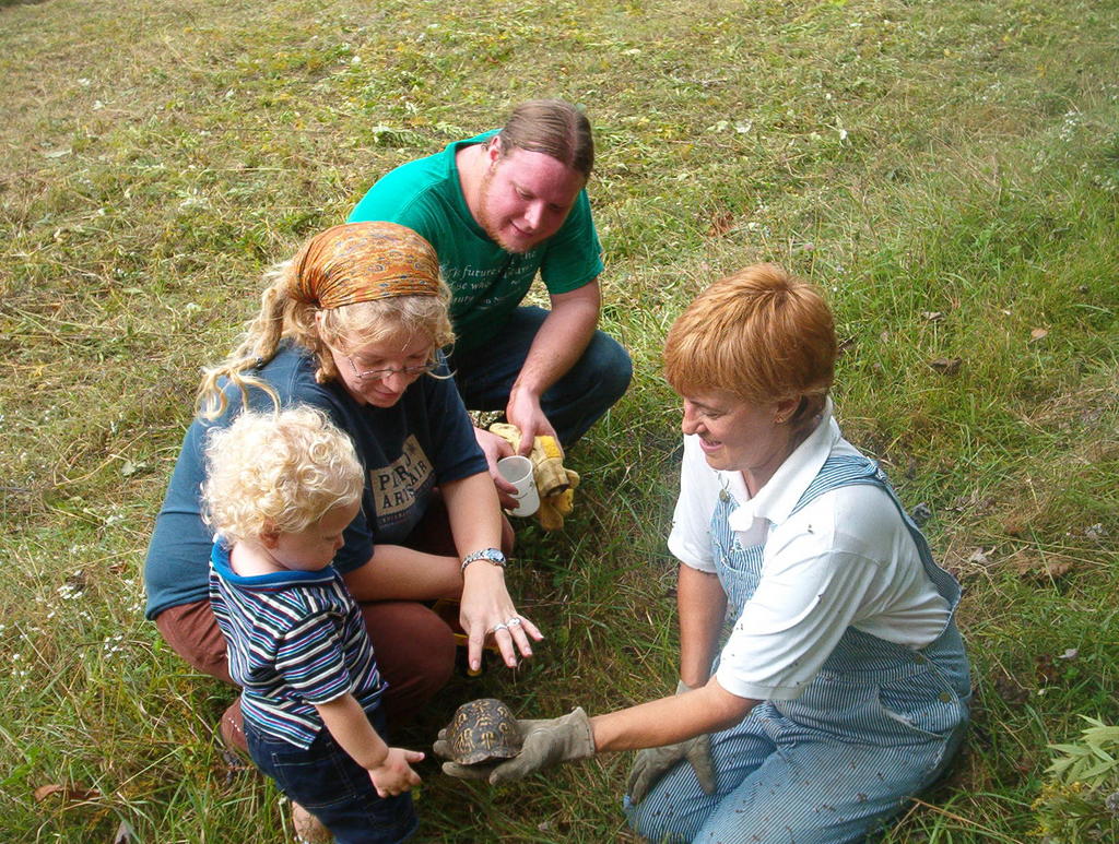 This box turtle is typical of many found at Raccoon Creek. It is probably the first that our youngest helper has ever seen. I'm amazed they can make headway through the tall meadow plants.
We still could benefit by consolidating some of our wood stacks and moving one or two a bit further from the center of the clearing. Maybe when it cools off a bit. It's not supposed to be in the high 80's in October.
Subscribe to:
Posts (Atom)